a number of different things that are grouped together
Cardiff Railway map
Last Updated on 25th October 2025
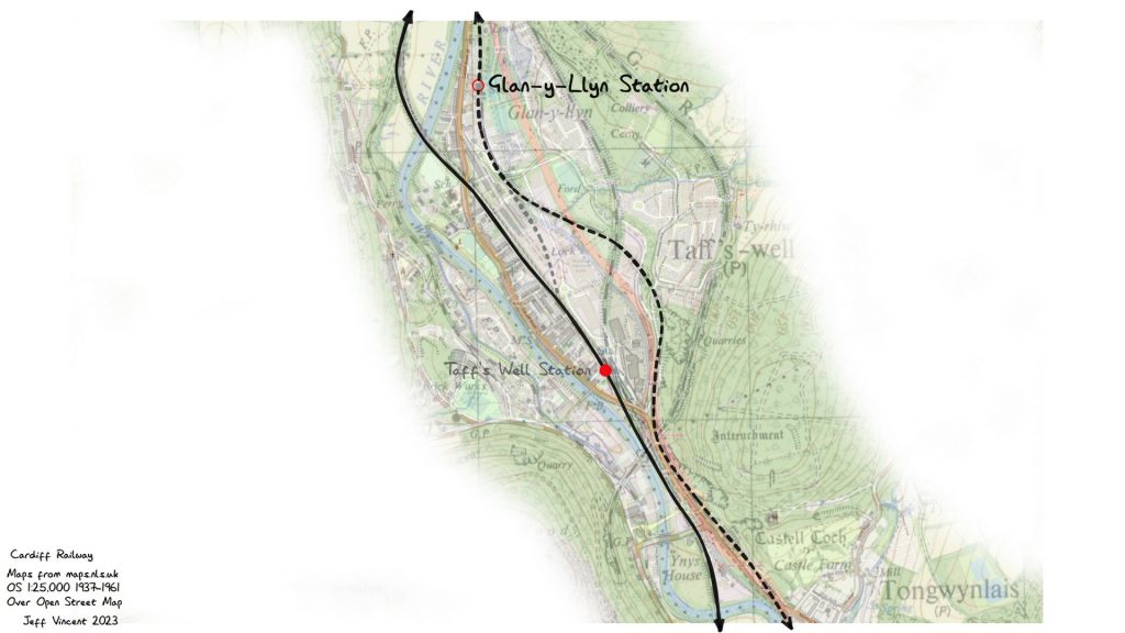
I created this map by overlaying the modern OpenStreetMap with the OS 1:25,000 1937-1961 map (courtesy of the National Library of Scotland map website). I then marked out the route of the Cardiff Railway and associated nearby TfW lines that are still running.
Cardiff Railway (dotted) from connection to TVR to past Upper Boat. TVR (and current TfW) line on the left from Cardiff Queen Street towards Pontypridd.Cardiff Railway (dotted) past Nantgarw and Glan-y-Llyn. TVR (and current TfW) line on the leftCardiff Railway (dotted) past Glan-y-Llyn and round Taff’s Well. TVR (and current TfW) line on the left. The short grey dotted line shows the 1952 connection from the old TVR along the Cardiff Railway to the colliery at NantgarwCardiff Railway (dotted) past Tongwynlais to the current Coryton and Whitchurch stations, where the remains of the line still exist as part of the Cardiff City Line. TVR (and current TfW) line on the left heading to Radyr and then Queen Street.The remaining part of the Cardiff Railway still in use through Rhiwbina, Birchgrove, Ty-Glas, and Heath Low Level and showing the original track alignment for the junction with the now TfW line from Queen Street toward Caerphilly
We use cookies on our website to give you the most relevant experience by remembering your preferences and repeat visits. By clicking “Accept”, you consent to the use of ALL the cookies.
This website uses cookies to improve your experience while you navigate through the website. Out of these, the cookies that are categorized as necessary are stored on your browser as they are essential for the working of basic functionalities of the website. We also use third-party cookies that help us analyze and understand how you use this website. These cookies will be stored in your browser only with your consent. You also have the option to opt-out of these cookies. But opting out of some of these cookies may affect your browsing experience.
Necessary cookies are absolutely essential for the website to function properly. This category only includes cookies that ensures basic functionalities and security features of the website. These cookies do not store any personal information.
Any cookies that may not be particularly necessary for the website to function and is used specifically to collect user personal data via analytics, ads, other embedded contents are termed as non-necessary cookies. It is mandatory to procure user consent prior to running these cookies on your website.